
EPA Water Quality Monitoring Datasets
EPA Water Quality Monitoring Datasets available through on the EPA Geoportal
EPA water quality monitoring datasets
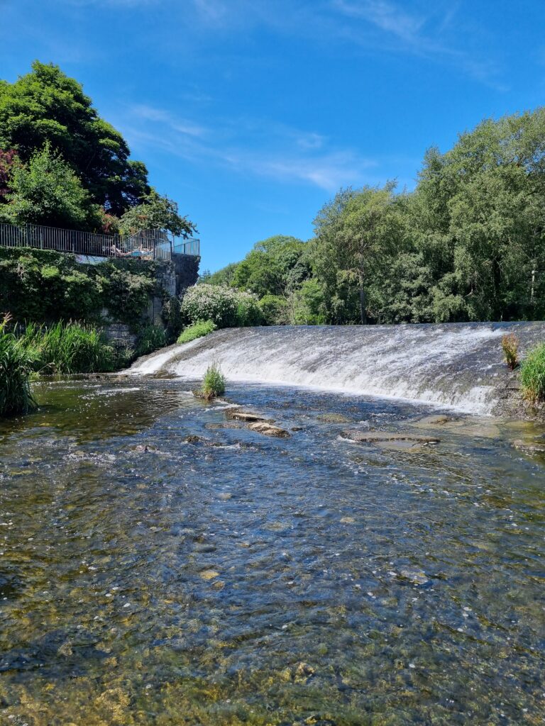
The Water Framework Directive (WFD) monitoring led by the Environmental Protection Agency (EPA) provides a coherent and comprehensive national overview of the ecological and chemical status of surface waters (rivers, lakes, transitional and coastal waters) and the quantitative and chemical status of groundwaters. This information is used to track progress towards the achievement of the environmental objectives required by the WFD and as set out in Ireland’s national River Basin Management Plan (RBMP), and to assess change in the quality of Ireland’s aquatic environment over time.
A number of EPA water monitoring datasets are now available to download through the EPA Data Geoportal. These data provide easier access to key information on supporting data used in river and lake ecological assessments for the Water Framework Directive.
These datasets may be of interest to researchers, consultants, and public bodies working on Water quality improvements and related environmental analyses, or to the public interested in the local rivers or lakes.
Available datasets
River Monitoring Datasets
The following river monitoring datasets are now available for download:
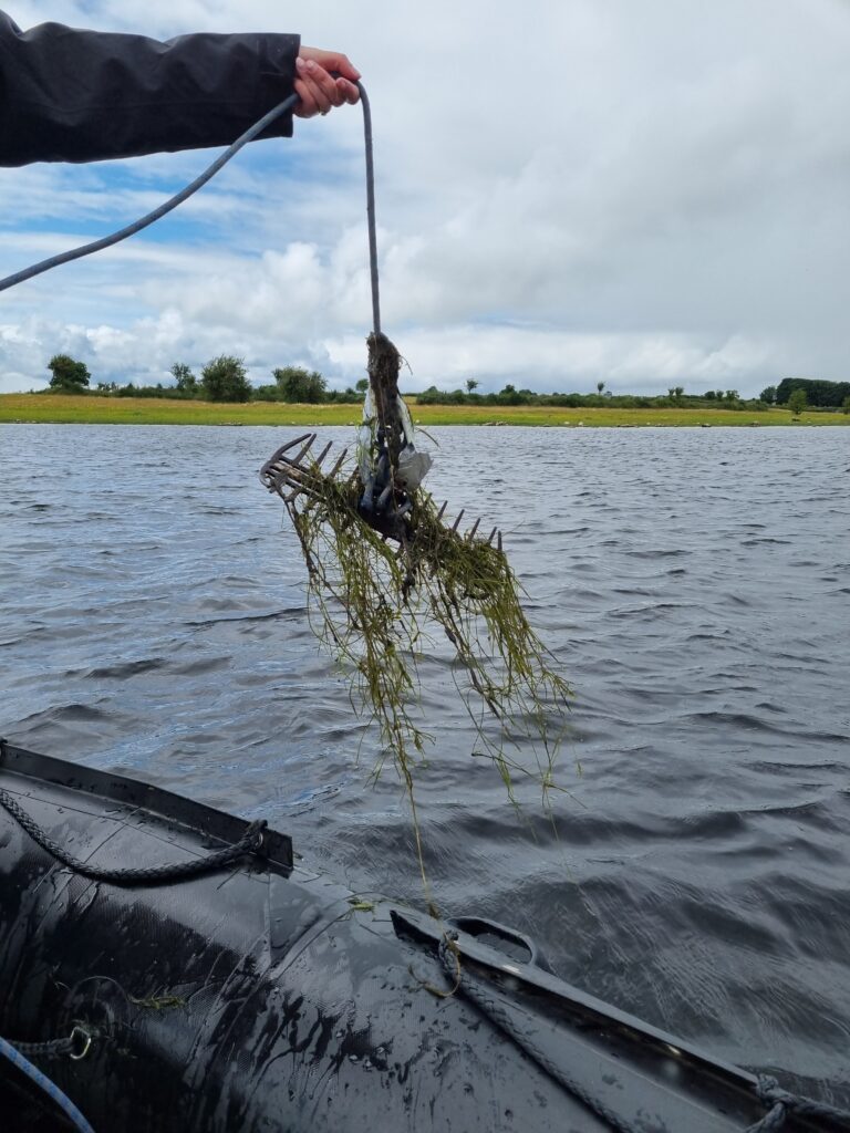
- EPA River Invertebrate (Q‑value) Data: Macroinvertebrate data used in the assessment of ecological status of rivers under the WFD.
- EPA River Invertebrate (AWIC) Data: Macroinvertebrate data used in the assessment of ecological status of acid-sensitive rivers under the WFD.
- EPA River Habitat Assessment Technique (RHAT) Data: Hydromorphological assessment scores used in the assessment of ecological status of rivers under the WFD.
Lake Monitoring Datasets
The following lake datasets are now available for download:
- Lake Phytoplankton Taxonomic Data: Phytoplankton data used in the assessment of ecological status of lakes under the WFD.
- Lake Macrophyte Data (Free Index): Aquatic plant used in the assessment of ecological status of lakes under the WFD.
- EPA Lake MImAS Hydromorphological Assessment Data: Hydromorphological assessment scores used in the assessment of ecological status of lakes under the WFD.

Guidance for Data Users
Each dataset includes a comprehensive Read Me section. These provide essential information on:
- Dataset scope and coverage
- Methods and classification systems used
- Appropriate interpretation and use
- Update history and limitations
Users are strongly encouraged to consult the relevant Read Me included with each dataset before using or interpreting the data. Most common queries are addressed there. Each dataset will provide contact information if further queries or information is required.
How to download the data
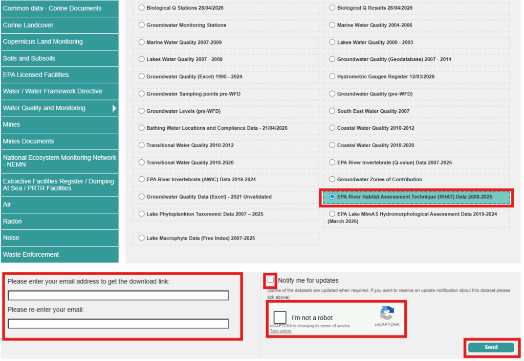
1. Access EPA Geoportal Data Download section: https://gis.epa.ie/GetData/Download
2. Navigate to ‘Water Quality and Monitoring’ or ‘Water / Water Framework Directive’ section in the left hand menu to locate the dataset you are after.
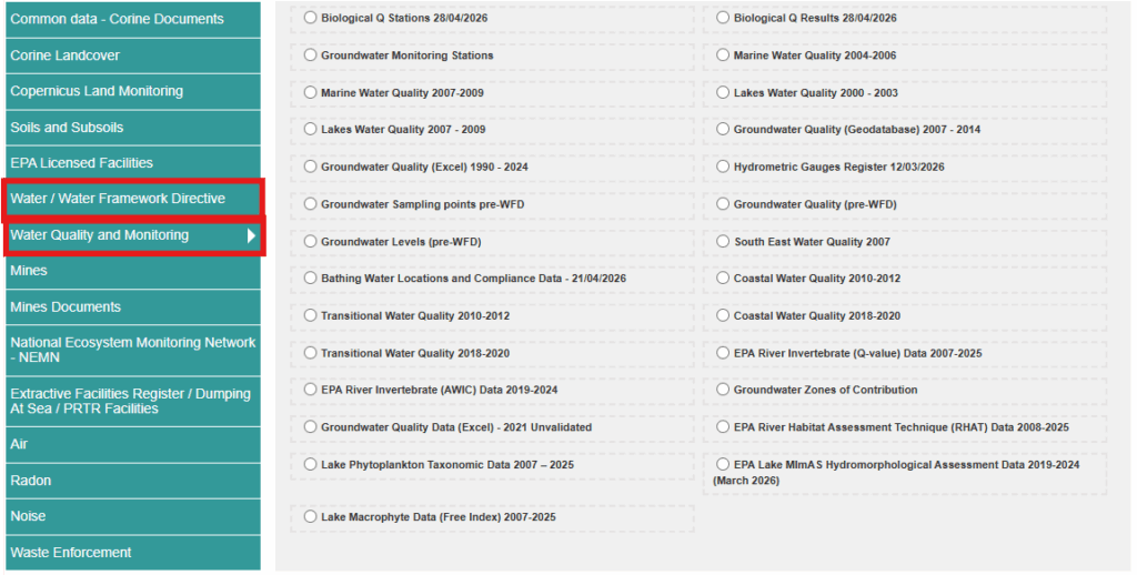
3. Select the data set you would like to receive. Complete the information required and send your request.
4. You will receive an email with your requested dataset.
Further information
Environmental Protection Agency, Ireland (EPA) Geoportal This geoportal is designed to make data about the environment easier to find, browse and understand. See Maps using our web mapping tools, Get Data directly to download and use in your own GIS systems, Ask and Learn to better understand our data.
WFD Data and Dashboards – Catchments.ie – Catchments.ie Data pages for all waterbodies and WFD Dashboards are available on catchments.ie to show you information about water quality as assessed under the Water Framework Directive.
Monitoring & Assessment: Freshwater & Marine Publications | Environmental Protection Agency EPA published reports and guidance documents on Monitoring and Assessment: Freshwater & Marine.
EPA_WFD_MonitoringProgramme_2022_2027.pdf
National River Macroinvertebrate Surveys Data in Ireland – Catchments.ie – Catchments.ie The Environmental Protection Agency (EPA) in Ireland is responsible for the ecological monitoring and assessment of over 13,000 km of river channel nationwide. Our national macroinvertebrate dataset, collected for WFD purposes from 2007 onwards is now available for download.
Who is involved?
Quite simply, everyone in Ireland has a role to play. This can be from something as simple as making sure you don’t pollute your local stream, or a local community working together to establish a Rivers Trust to enhance the rivers and lakes in their area, to a Government Department or Agency helping a Minister implement a new policy to help protect and enhance all our water bodies.
This website has been developed and is maintained by the Environmental Protection Agency, and is a collaboration between the Department of Housing, Planning and Local Government, the Environmental Protection Agency, and the Local Authority Waters Programme.
Local Authority Waters Programme
The Local Authority Waters Programme coordinates the efforts of local authorities and other public bodies in the implementation of the River Basin Management Plan, and supports local community and stakeholder involvement in managing our natural waters, for everyone’s benefit.

Environmental Protection Agency
The EPA is responsible for coordinating the monitoring, assessment and reporting on the status of our 4,842 water bodies, looking at trends and changes, determining which waterbodies are at risk and what could be causing this, and drafting environmental objectives for each.

Department of Housing, Local Government and Heritage
The Department is responsible for making sure that the right policies, regulations and resources are in place to implement the Water Framework Directive, and developing a River Basin Management Plan and Programme of Measures to protect and restore our waters.