Rivers trusts are charities, established by local people to look…
Citizen Scientists: Can you help map river obstacles?
Reconnect is an EPA-funded project being undertaken by a team of researchers from University College Dublin. Its aim is to assess the extent and impact of flow barriers or obstacles in rivers on freshwater biology, hydromorphology and connectivity in Ireland. A key task is to develop a systematic methodology for mapping the location of barriers or obstacles in Ireland’s rivers.
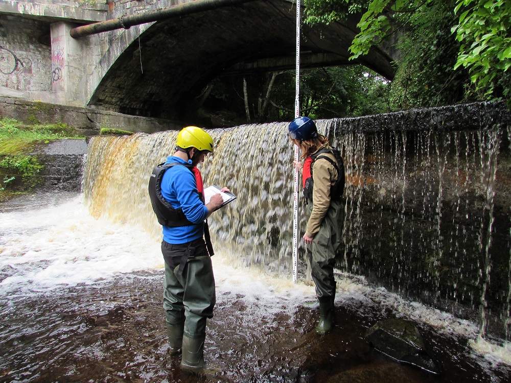
A river obstacle is a physical structure, either natural or manmade, located within a river channel. Man-made obstacles include dams, bridge aprons, weirs, sluices and culverts. These have the potential to prevent or delay the up- or downstream movement of fish, invertebrates and river material including sediment.
Natural obstacles such as waterfalls, log-jams and fallen trees can also limit the movement of fish and invertebrates, so knowing their locations relative to man-made obstacles is important. The impact of a range of barriers on the physical habitat of rivers and aquatic organisms such as fish and invertebrates will be assessed as part of the project. This information will be used to produce a validated multi-criteria decision-support tool for prioritising the selection of barriers for modification or removal.
River obstacles and citizen science via a mobile app
REMEMBER : SAFETY FIRST! ALWAYS TAKE CARE WHEN NEAR THE WATER. SEE WWW.IWS.IE FOR GUIDES TO STAYING SAFE.
Mapping the locations of river obstacles is not a simple task. Ireland has a vast river network (74,000 km) and it is suspected that there are hundreds of barriers in most major river catchments. For instance, a field study of the Nore catchment identified 508 potential obstacles and, of these, 497 were man-made structures (Gargan et al., 2011).
The Reconnect project employs “citizen science” techniques to help identify and record these river obstacles and has linked up with the UK River Obstacles project (http://www.river-obstacles.org.uk) to use their mobile phone app to allow anyone near a river to record the location and type of manmade and natural obstacles they see. We encourage all citizens who access rivers (e.g. anglers, canoeists, walkers) or have an interest in the health of Ireland’s rivers to download the app and use it to record any river obstacles or barriers that they may encounter.
The app is free to download and easy to use. One simply takes a photograph of the obstacle and notes some details. The app uses the GPS facility built into a smartphone to map the location. In remote locations where a signal may not be strong enough to use the app, the UK River Obstacles team have developed facilities for information to be captured locally and then entered via the website or by the mobile app at a later time. For example, it is possible to upload a photograph directly from the picture album in a smartphone and manually enter the location of the obstacle when a stronger signal is available. All data collected by the app are stored on a secure central database. The records are verified by members of the Reconnect team.
The information will be used to help build a georeferenced data layer of river obstacles in Ireland and will have many uses into the future. It will initially help identify river obstacles for further assessment. The information will also have many other uses, for example a canoeing or kayaking club may use the data to identify potential hazards along a river while planning a trip.
Download the River Obstacles App
The river obstacles app can be downloaded for free from Google Play and the iTunes App Store. Links to the app can also be found on the River Obstacles website (www.river-obstacles.org.uk/) and the Reconnect Facebook page.
To find out more about the project please visit our website (www.ucd.ie/reconnect), like us on Facebook (www.facebook.com/ReconnectRivers/),
or follow us on Twitter (@Reconnect_News).