The EPA report Water Quality In Ireland 2013-2018 was originally…
Water Quality in Ireland 2019–2024: Figures and Maps Now Available
Download maps and figures from the EPA’s Water Quality in Ireland 2019–2024 report via EPA Geoportal.
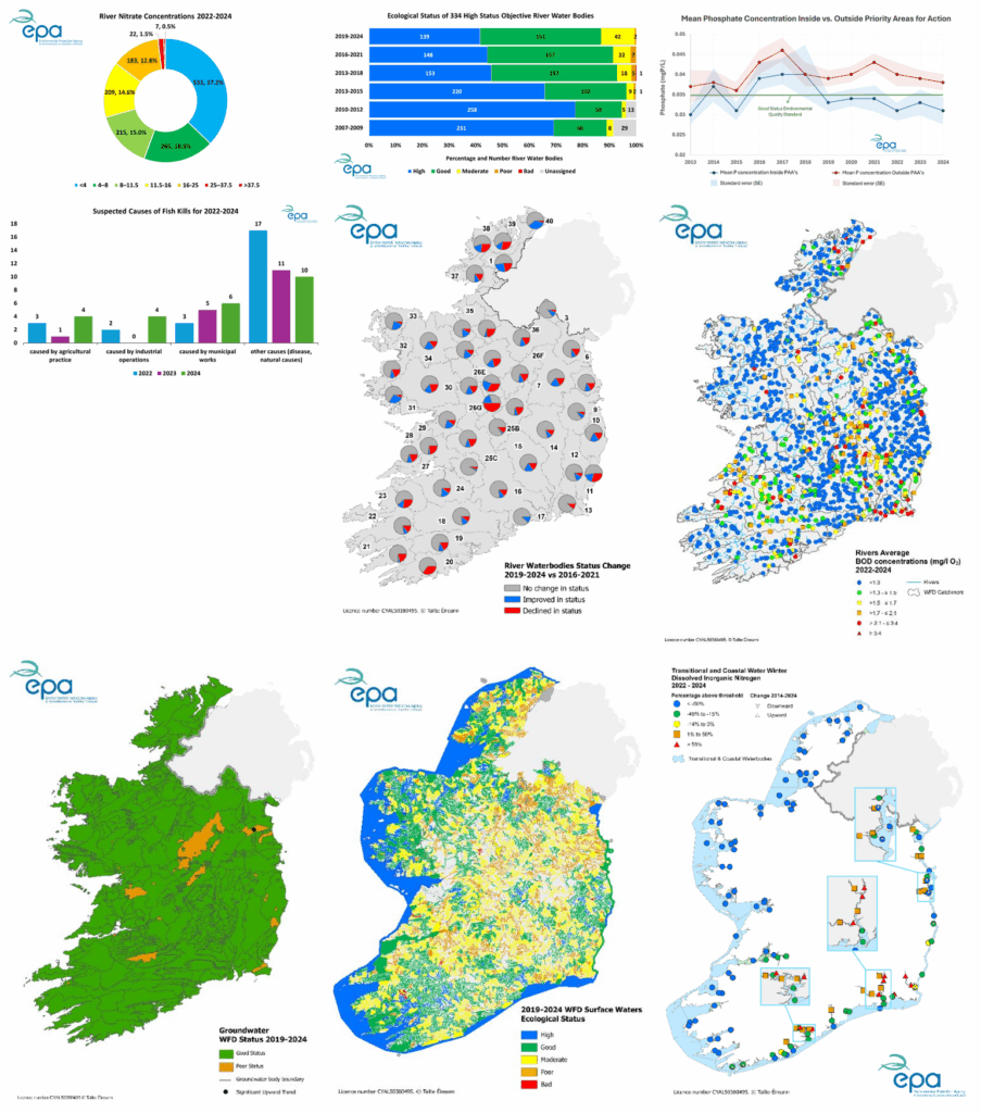
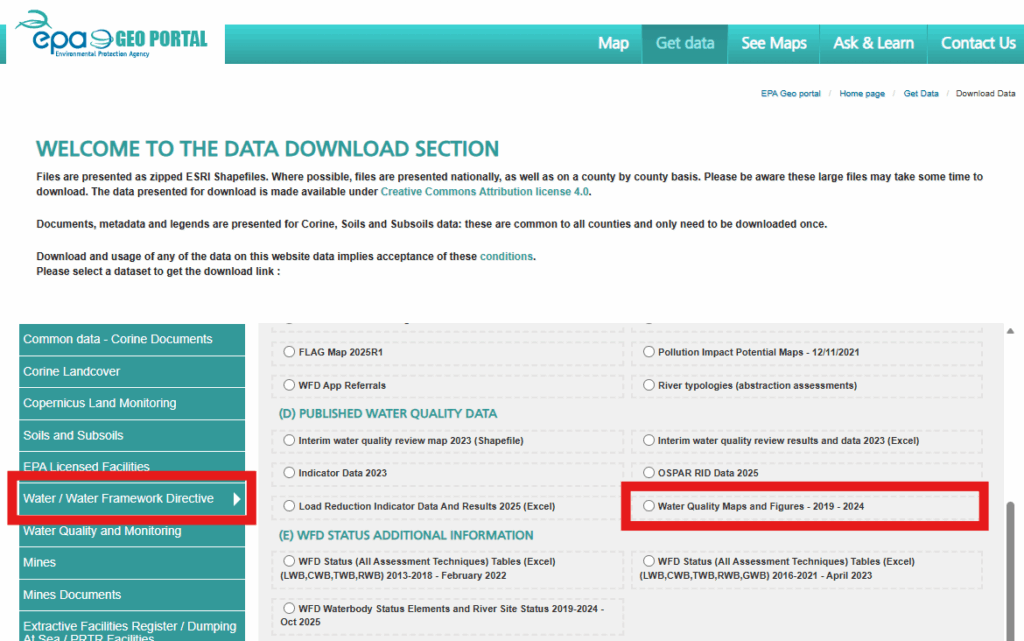
The Environmental Protection Agency (EPA) has made all figures and maps from the Water Quality in Ireland 2019–2024 report publicly accessible. These resources provide detailed insights into the state of Ireland’s rivers, lakes, estuaries, and coastal waters over the past five years.
You can download the files via the EPA Geoportal:
- Go to https://gis.epa.ie/GetData/Download
- Navigate to: Water / Water Framework Directive → (D) Published Water Quality Data → Water Quality Maps and Figures – 2019–2024
Researchers, educators, and community groups can use these materials to explore Ireland’s water environment. They support transparency and informed decision-making on water quality and environmental protection.