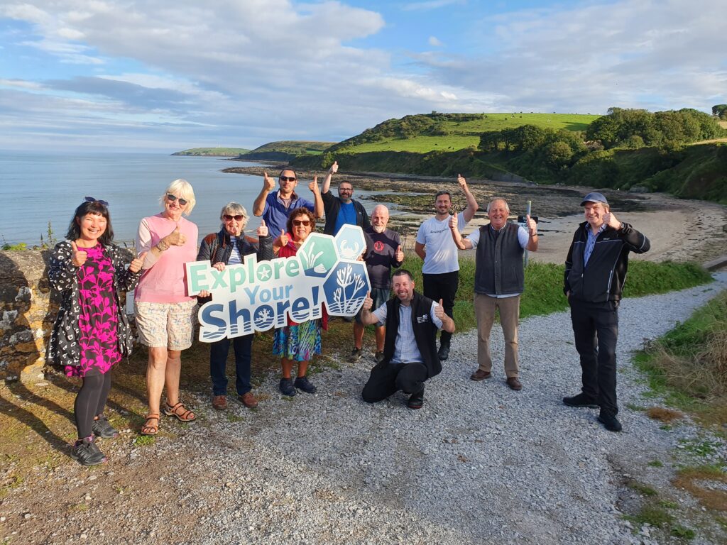
The National Biodiversity Data Centre today launched our Rocky Shore…
Explore Your Shore! – Ireland’s Marine Citizen Science Movement
Ireland’s coastline is not only a place of natural beauty but is also rich in biodiversity. However, human activities are putting pressure on our coastal ecosystems. Issues such as global warming and declining water quality, both driven by human activities, are major public concerns. In 2019, the EPA funded a Citizen Science project through the National Biodiversity Data Centre to investigate what freshwater and marine species can tell us about the effects of climate change and water quality on Ireland’s aquatic environment.
What is Explore Your Shore! ?
Explore Your Shore! is building our knowledge of marine species around the Irish coast, and what they tell us about climate change and water quality in our coastal ecosystems. It is a national citizen science project aimed at documenting Ireland’s coastal and intertidal biodiversity. By engaging the public in recording marine species, the project seeks to establish a comprehensive baseline dataset for intertidal plant and animal species, utilise intertidal species as indicators of climate change and water quality, and raise public awareness about the impacts of climate change and water quality on Ireland’s marine biodiversity. Explore Your Shore! is managed by the National Biodiversity Data Centre and, working in partnership with other Irish marine biodiversity citizen science projects, serves as a platform for marine biodiversity citizen science in Ireland.
Participating in Explore Your Shore! Surveys
Explore Your Shore! offers a variety of surveys tailored to different interests, and levels of expertise:
- Seashore Spotter: Ideal for casual observers, this survey encourages the public to submit records of any marine species encountered along the coast, even if they cannot identify them.
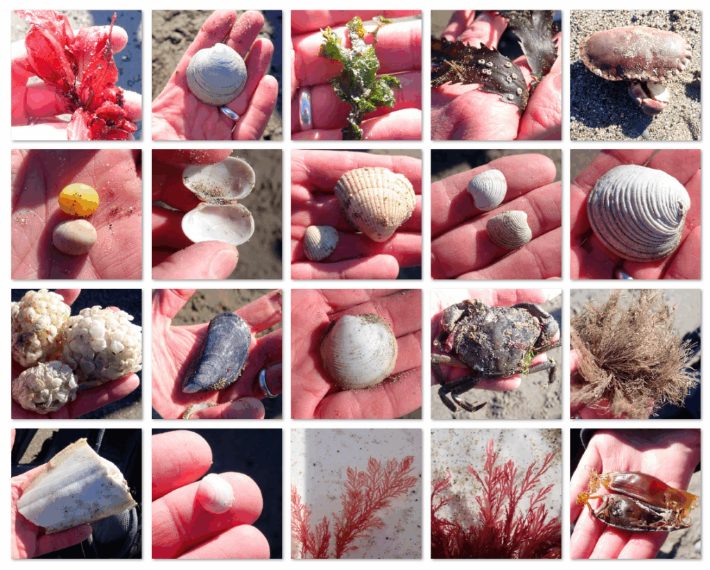
- The Big Beach Biodiversity Survey: Participants record marine species found washed ashore on beaches. It is a proxy-survey of what lies beneath the adjacent sea surface, contributing to data on species distribution and abundance.
- The Great Rocky Shore BioBlitz: Aimed at more enthusiastic marine species recorders, this survey challenges participants to record as many marine species as possible in a specific location.
- Adopt-a-Rockpool!: This initiative invites individuals or groups to regularly monitor a chosen rockpool, fostering a deeper connection with local marine biodiversity and monitoring changes in marine species over time.
These surveys are designed to be accessible to non-experts, requiring only access to a camera or smartphone, and uploading data through a user-friendly web form. Detailed instructions and resources are available on the Explore Your Shore! website to guide participants through the process of participating in each survey. We also have a free online course where you can learn about marine biodiversity citizen science and how to find, identify and record marine species.
Collaborations with Partner Marine Surveys
Explore Your Shore! acts as a platform for marine biodiversity citizen science in Ireland and collaborates with several partner organisations to that end. These include:
- Seasearch Ireland: Engaging divers in recording marine habitats and species.
- Irish Whale and Dolphin Group: Collecting sightings and strandings of cetaceans around the Irish coast.
- Purse Search Ireland: Encouraging the public to record shark, skate, and ray egg cases found on beaches.
- Irish Basking Shark Project: Collecting data on basking shark sightings to aid in their conservation.
- The Big Jellyfish Hunt: Gathering records of jellyfish and jellyfish-like species in Irish waters.
These projects enhance the scope of marine biodiversity data collected in Ireland, contributing to a more comprehensive understanding of Ireland’s marine ecosystems.
Achievements and Impact
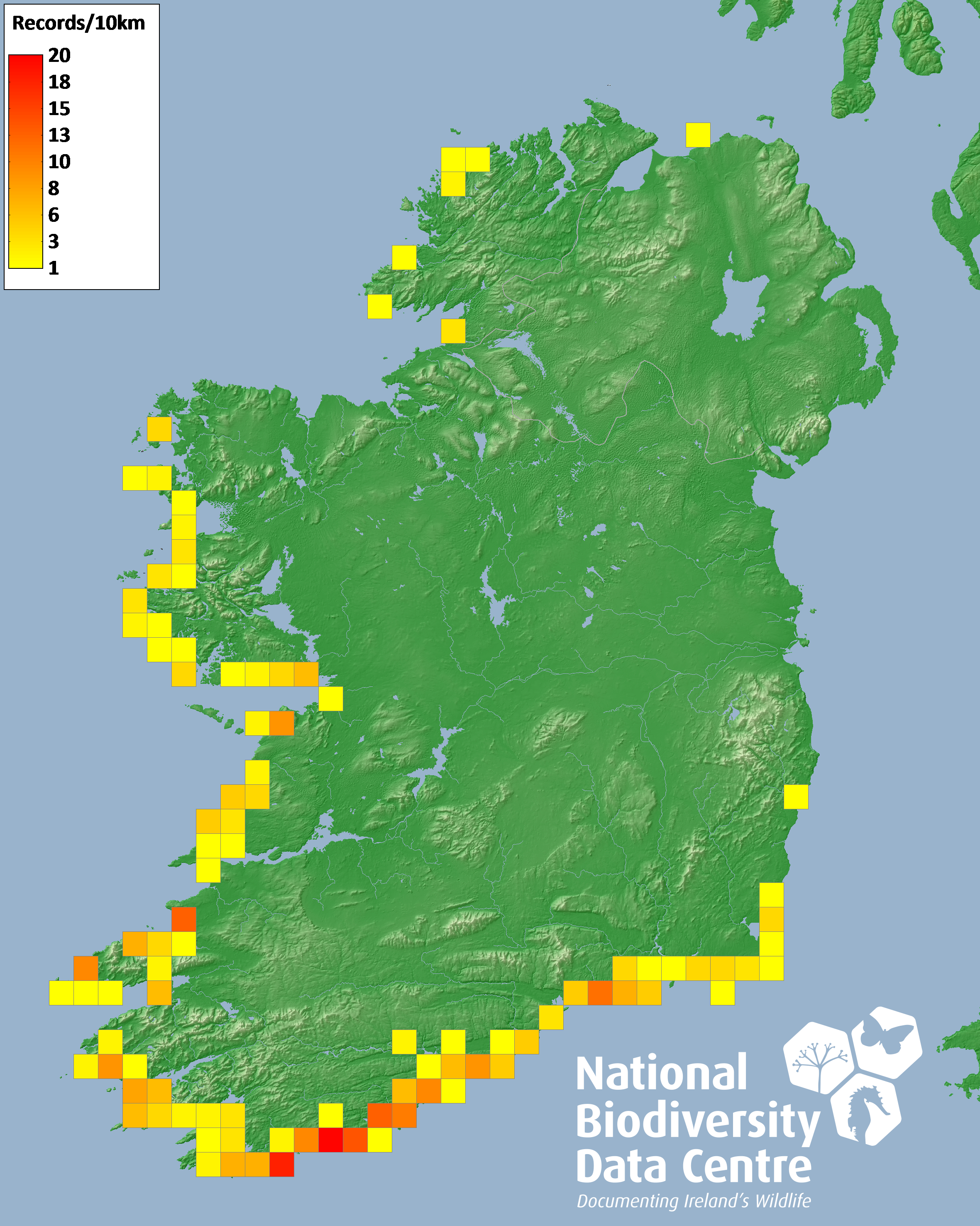
Since its inception, Explore Your Shore! has made significant strides in marine biodiversity data collection. Since 2019, over 25,789 records of 783 marine species have been submitted by more than 1,600 participants at 2,289 sites around the Irish coast. The National Biodiversity Data Centre has witnessed an almost 500% increase in marine species records submitted via its Citizen Science Portal, highlighting growing public interest and involvement in marine biodiversity recording.
We periodically review species distributions evidenced by Explore Your Shore! data and compare them to any available baselines. Through this process we identify species with restricted distributions around the Irish coast, that may be impacted by climate change. We also look for species with known sensitivity to nutrient enrichment that may be usefully monitored as indicators of water quality. Explore Your Shore! data also helps record new marine invasive species and map the distributions of existing marine invasive species in Ireland.
Through workshops, online courses, and identification resources, Explore Your Shore! has trained and educated thousands of people on marine species identification and the importance of marine biodiversity recording. These efforts not only enrich our understanding of coastal marine biodiversity in Ireland but are building a community of informed and engaged marine biodiversity citizen scientists.
How to Get Involved
Becoming a citizen scientist with Explore Your Shore! is quite straightforward:
- Visit the Website: Explore the various surveys and choose one that fits in with your interests.
- Access Resources: Utilise the identification guides, survey forms, and online courses available to help build your knowledge of and interest in marine species identification and recording.
- Conduct Surveys: Head to your local coastline, observe and record marine species, taking a photograph of each species recorded, and follow the provided guidance on how to ensure accurate data collection.
- Submit Data: Upload your findings through the National Biodiversity Data Centre’s Citizen Science Portal
By participating in Explore Your Shore! you can play a vital role in monitoring and protecting Ireland’s marine biodiversity.